
Gaia app: A must-have
GPS tool for travelers
I can barely remember a time before GPS. Just like cell phones or the internet, I’m pretty sure there WAS life before it, but how on earth did we ever manage? GPS is one of those magical technologies that rocked the world, and the Gaia app is an outgrowth from that. This GPS app has totally changed how I travel, and I can’t live without it anymore!

I use my Gaia app all the time when I’m traveling, and even before I start a trip, way back in the planning stages. It’s an absolute essential. There aren’t many apps that I am willing to pay a subscription for, but if you are into overland travel, this one is worth its weight in gold.
Quick Navigation
- GPS apps and tools
- GPS definitions
- GPS required features
- Gaia app walkthrough
- Summary
- Questions? Comments?
GPS apps and tools
- Your phone uses GPS when you navigate with Apple Maps or Google Maps, but neither of these are full featured GPS apps. They can navigate you from point A to point B, but they’re missing a lot.
- Ideally what you want is a fully functional GPS tool that works WITH your navigation apps, and that’s where the Gaia app comes in.
GPS apps vs. dedicated devices
- You can buy a stand-alone GPS device that mounts in your car and provides the same type of navigation, or you can use an app that runs on your phone.
- Personally, I far prefer using the Gaia app on my phone to having another device. Here’s why:
- An app on my phone integrates smoothly with my other apps. I can copy / paste coordinates from an e-book into my Gaia app, or from Gaia to Apple Maps. There’s no need to type coordinates into a separate device.
- I always have my phone with me, whether I’m driving or on foot. Even while I’m sipping a margarita at a beach bar, I can be looking at my GPS maps or updating my waypoints. That won’t be the case with a standalone device.
- My camper is a tiny house, and optimizing space is a priority. One device that serves many purposes is preferable to taking the extra space for single-purpose devices.
- It’s one less device to keep updated.
- It’s less expensive than buying another device and the maps it needs.

I tried quite a few other GPS apps in the past. They all started out sounding good, but came up short for my needs. There was a lot of frustration (and some bad language too) when I was out in the boonies somewhere and couldn’t get things to work.
Then I discovered the Gaia GPS app, the love of my life. 💚
GPS 101 – A few definitions
- Waypoints are place markers. At a minimum each waypoint has a name and a set of GPS coordinates. Depending on what GPS tool you’re using, it may also have a custom icon, elevation, notes, or photos.
- Routes are paths on the map that you create in the software. It could be a straight line from A to B, or a complicated path following sections of different winding roads.
- Tracks are paths which are recorded from your physical GPS locations as you travel. The route is the plan, while the track is the actual result.
GPS apps – required features
Here’s the list of features which I consider necessary for a full-featured GPS app.
The basics
- Works offline
- Waypoints, routes, and tracks
- Trip information
- Works with navigation apps
- Ways to organize data
Maps and coverage
- Quality maps
- Variety of map types
- Don’t need to buy individual maps
- Worldwide coverage

Technology
- Cloud backup
- Data sharing
- Multiple platforms
- Cross device syncing
Optional extras
- Photos attached to waypoints or tracks
- Land ownership maps
- Selective syncing
- Discovery options via other people’s waypoints and tracks
Gaia app – Feature walkthrough
Here’s how the Gaia GPS app stacks up with that list of required features. You can find it on their website gaiagps.com.
Gaia app basics
- Works offline. There is no sense having a GPS app that won’t work when there’s no cell service. I ran into this during my experimenting days, and it’s useless! 😰 Even if you don’t spend as much time in the middle of nowhere as I do, you’re bound to drive through places with no cell service. The Gaia GPS app lets you work offline by getting the maps on your phone in advance while you have internet. They you can access and use them with no problem when you’re offline.
- There are two ways to get the maps onto your devices. (a) Download maps in advance that cover user-defined map regions, or (b) Use the cache. Whatever you’ve been looking at recently will be stored in the cache, and available offline.
- Waypoints. In the Gaia app, it’s easy to create waypoints based on my current location, a chosen spot on the map, or GPS coordinates that I type in or cut and paste. Waypoints can have custom symbols or colors, photos, and extensive notes.
- Routes. You can plot a route on the map in Gaia, either letting it follow the roads for you, or manually placing the route exactly where you want it. I like this for hiking and backpacking. I can plan out a route for a day, and get a ton of information about what to expect, including an elevation profile so I know where the tough bits will be!
- Tracks. In the Gaia app, to record your track, just click to start recording, then click again at the end and give your track a name.
- I like to keep recorded tracks for all of my travel days, so that I can put them together and get an overview of exactly where I went on that trip. Also next time I’m going to that area, I can see where I went before, and have all the details about mileage, times, etc.

- Trip information. The Gaia app gathers a lot of trip information automatically. For both routes and tracks, it will show distances, elevation gain and loss, and an elevation profile. For recorded tracks, it also includes actual time and speed information.
- Works with navigation apps. When you open any waypoint, the Gaia app lets you select “Driving Directions”. This will take you directly to either Apple Maps (iOS) or Google Maps (Android) to navigate you to that point. If you want to use a different navigation app like Maps.me, you can copy the coordinates here and then paste them into the other app.
- Organizing data. I’ve got hundreds of tracks and thousands of waypoints. Once you’ve used your favorite tool for a few years, you will too! You need a way to organize all of this so you can quickly find what you want.
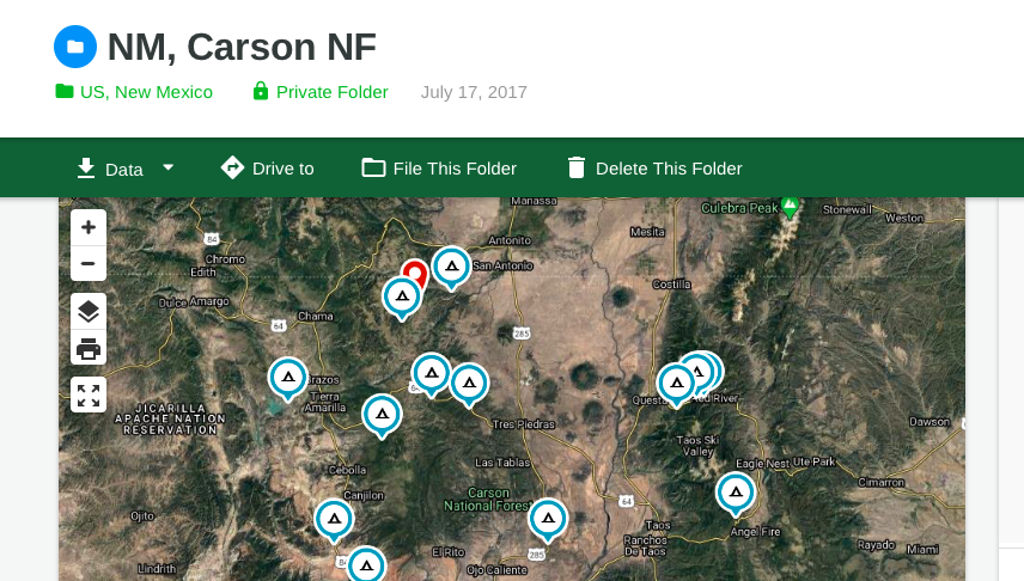
- In the Gaia app, you can define a nested folder structure for storing your waypoints, routes, tracks, and maps. For instance, I have folders for USA > New Mexico > Carson National Forest, so when I want my waypoint for a sweet campsite I remember, I know just where to find it.
Gaia GPS maps and coverage
- Quality maps. The better the maps, the more useful the tool will be. In Gaia GPS, this is excellent. You can zoom out to see an overview of a large area for relative positioning of things. Then there’s enough detail that you can zoom in to see a specific building.
- Variety of map types. For city driving, you want a street map. To visualize your route through the mountains, a terrain map is helpful. For hiking and backpacking, a topographic map is ideal. For checking out possible campsites, there’s nothing like a satellite image map. The Gaia app gives you all of these options and many more.
- And if you’re boondocking, there are some premium map layers available that cost extra but can be super useful. A land ownership map will confirm where the boundaries of a BLM area are, and a Motor Vehicle Use Map (MVUM) will show specifically where dispersed camping is allowed in the national forests.

- Don’t need to buy individual maps. Buying extra maps to visit other areas or see different details is a hassle, and can get expensive too. It’s far preferable to have everything you might want included up front. Gaia includes a ton of maps with the basic subscription. As mentioned above, there are extra maps available with an upgraded membership, but that covers everything else. You don’t need to purchase separate maps.
- Worldwide coverage. Why settle for something that will only cover you in the United States or some other limited geographic area? With the Gaia app, whether I want to look at things in Bali or Nova Scotia, Tucson or Timbuktu, there are maps included for what I need.

Gaia app technology
- Cloud backup. I create GPS data on my devices, but want it to also be backed up to the cloud, just in case. This happens automatically in the Gaia app when your device is connected to the internet.
- Data sharing. Your friend asks you for coordinates of that awesome camping spot you posted on Instagram, or you want to share a route you planned with friends traveling together. There’s an import / export capability in Gaia to let you transfer data back and forth to other people.
- Multiple platforms. I’ve got an iPhone, iPad, Android phone, and MacBook, and want something that will run on all of those. I use the phone most often, but the iPad is great for seeing a bigger map, and the laptop is best for organizing a larger amount of data. The Gaia app works on both iOS and Android phones and tablets, and you can access the web version from any browser.
- Cross device syncing. I might import a set of waypoints on my laptop, plan out a route on the iPad, and record my day’s driving track on the phone. All of these need to sync with each other, so that each device ends up with the full set of information. The Gaia GPS app does this well. Each device will sync its data when attached to the internet.
- Selective syncing. I don’t really need ALL my data on ALL my devices ALL the time. That just takes up space and makes it harder to find things. It’s nice to have a way to carry just the data I need soon with me, and leave the rest securely in the cloud.
- On the Gaia website you can see all of your data, and select which items you want to sync to your devices. If I’m going to Portugal, I can set it to sync my Portugal folders to my devices, while omitting Colorado, Yucatan and everywhere else.

Summary – Gaia app for the win!
The Gaia app is hands down my favorite app, and for me it’s an absolute essential for travel. Yes, it does cost money, but just the money I save by not buying so many paper maps is enough to more than cover the cost of the subscription.
Note: I do still buy some paper maps, but just a few for high level planning, not maps to cover all the details. I can’t even imagine having to navigate through a major city using paper maps anymore!
One caveat
- I’ve been using Gaia for years on my iPhone, iPad and Mac (website). I recently added an Android phone (because I really want more chargers)! 😉 The Gaia GPS app works there too, syncing with all the rest as expected. Excellent!
- However, I have noticed that the interface on Android is not as polished as iOS, and it seems a bit more glitchy. It’s still extremely useful on Android, so I recommend it whatever the platform. It’s just not quite as smooth yet, but I’m sure this will evolve over time.
Questions? Comments?
What do you use for GPS? Have you used the Gaia app, a different app, or a stand-alone device? Anything else you’d like to recommend to readers? Please leave any comments or questions in the Reply section below, and thanks for sharing!
PHOTO CREDITS: Satellite – SpaceX (Unsplash), Charts – Ruthie (Unsplash), Others – Deanna Keahey

Hi! I’m Deanna, creator of Uphill Zen. I’m currently yondering around somewhere, often with my Toyota motorhome, Zennie. What makes my heart sing is travel, adventure, and the wonders of nature. Sharing that joyous spirit is what this is all about.

Site search
Places
Categories
Popular posts

Discover the magic and mystery
This stunning new book takes you to the Yucatan Peninsula, an exotic and fascinating land.
- Explore ancient Mayan cities lost in the jungle
- Swim below the stalactites in exquisite cenotes
- View a thousand flamboyant flamingos
- Experience life in a Maya village
- See the inner workings of historic haciendas
- Find a tranquil beach to call your own
Hundreds of vivid color photos bring the magic of the Yucatan to life, and adventurous souls will find all the “how to” details you need to make each experience your own.

Mathew
Thanks for the share. Have Bookmarked your page.
Deanna Keahey
Thanks! Glad you found it useful. 🙂
Kirk Rigby
I travel around the states. As I travel I do some off highway trails. I’m planning a trip next year to Canada and Alaska. I want a GPS that I don’t have to download a different map every time I change states or zones. I want a GPS that has everything downloaded the first time. I’m thinking of getting a GPS iPad and getting a GAIA subscription. Do you know how big of an iPad I need for this. (GBS). Thanks
Deanna Keahey
Hi Kirk –
Thanks for the comment! Sounds like a fabulous trip! I’m sorry but there’s no easy answer to this because different maps need diff space for downloads. E.g. a satellite map will require more space than a street map for the same area, and even the satellite map will depend on what level of detail you select. I can tell you that downloading maps for all of the US and Canada would take quite a lot of space, but I can’t give you a number. Personally I download maps as needed, and remove from my device once I’m through that area. Good luck with it, and enjoy the trip! – Deanna.
PS. You might also look into maps.me. You can download maps there that don’t use as much space, but it’s not a full-featured GPS like Gaia. Definitely helpful though! 🙂